Philadelphia International Airport (PHL)
Driving Directions / Travel by Car
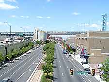
(Philadelphia, Pennsylvania - PA, USA)
Edged by the I-95 interstate (Delaware Expressway) to the north, the Philadelphia International Airport (PHL) is situated just minutes to the southwest of downtown Philadelphia, alongside the Delaware River. Also nearby is Tinicum, Essington and Chester to the east, Norwood and Collingdale to the north, and Paulsboro to the south, across the river.
Prominent routes close to Philadelphia Airport include Bartram Avenue to the north, the George C. Platt Memorial Bridge to the east, and Essington Avenue to the northeast. Also nearby is the I-76 interstate (Schuylkill Expressway), which heads in a northerly direction past Philadelphia and leads to the Pennsylvania Turnpike.
Directions to Philadelphia International Airport (PHL) from the downtown district
- Take the I-76 interstate and head south
- Exit the highway at Junction 43B
- Continue along the SR-291 highway in a southerly direction, following the signs
Directions to Philadelphia International Airport (PHL) from the PA Turnpike
- Head along the PA Turnpict and take the Mid-County Exit, heading along Route 476
- Travel south along the US-476 highway, towards Chester and the I-95 interstate
- Continue along the I-95 interstate and head in a northerly direction towards the airport
Directions to Philadelphia International Airport (PHL) from NJ Turnpike
- Travel along the NJ Turnpike and leave at Exit 3
- Cross the Walt Whitman Bridge and pass the toll plaza
- Head south along the I-95 interstate and follow the airport signs
Directions to Philadelphia International Airport (PHL) from Delaware
- Head in a northern direction along the I-95 interstate, following the signposts
Philadelphia International Airport (PHL): Virtual Google Maps
