Philadelphia International Airport (PHL)
Orientation and Maps
(Philadelphia, Pennsylvania (PA), USA)
Surprisingly close to New York City, Philadelphia is often overlooked as a city worth visiting. With many truly impressive museums, outstanding arts centers, plenty of fine dining and also a lively night scene, the city of Philadelphia really is worth exploring.
The city's airport is located on the southwestern outskirts, next to the Delaware River and the I-95 interstate (Delaware Expressway). Philadelphia International Airport (PHL) features a range of direct flights from all over Europe, Canada, and in excess of 100 cities around the United States.
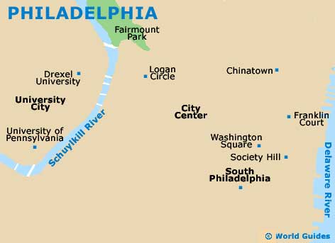
Philadelphia International Airport (PHL) Maps: Important City Districts
The city's Greyhound bus station can be found along Filbert Street and features regular services to New York, New Jersey and Washington DC, together with other important cities. Buses operated by the New Jersey Transit and Capitol Trailways also stop at this busy terminal. Located in the University City area, Philadelphia's Amtrak train station stands along 30th Street.
The majority of Philadelphia is really quite easy to find your way around and many places of interest can be reached on foot. The historic area of Philadelphia incorporates the Old City and also the National Historic Park, stretching in an easterly direction towards to waterfront. On the western side of this area you will find Center City, which includes the lively Penn Square area and also the City Hall. Other important parts of Philadelphia include the Schuylkill area, where you will find the vibrant Italian Market, and the Manayunk area to the northwest, which is home to plenty of top restaurants and pubs.
USA Map

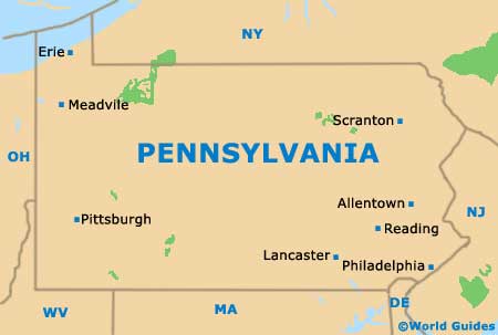
Pennsylvania Map
Philadelphia Map